Background:
Hangman Creek has suffered extreme degradation in the form of loss of riparian habitats and function, the ditching of wetlands and loss of wetland function, as well as excessive drainage systems originating in agricultural operations and running into the creek. Additionally, the Palouse loess soils have been routinely exposed through tillage practices that exacerbate erosional runoff of sediment and phosphorus (ref). As many as 200,000 tons of topsoil runoff and into Hangman and the Spokane River each year. Hangman has been studied but the Spokane River has received little attention to the impacts of sediment inputs on the aquatic biology of the Spokane River system.
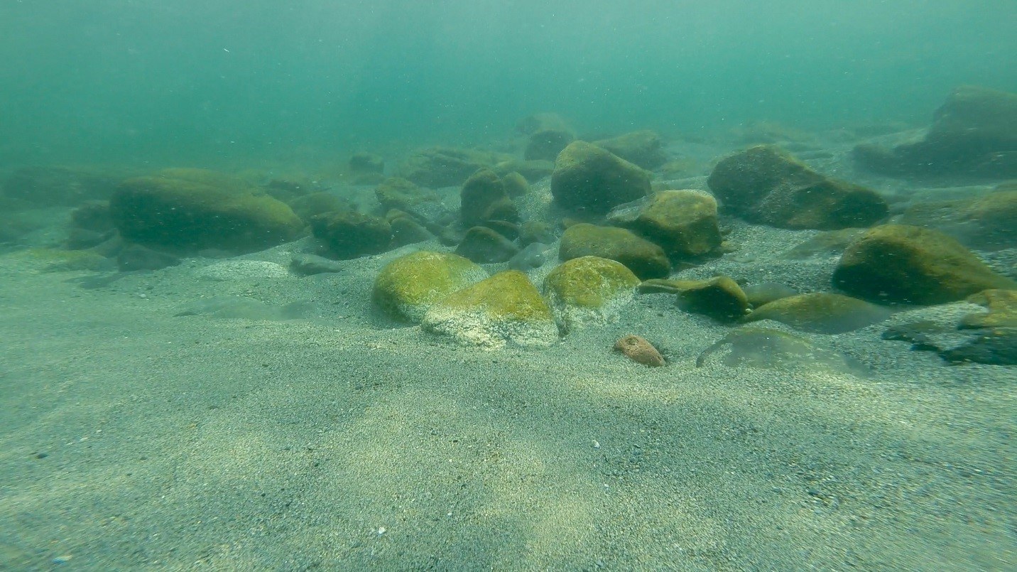
Few if any agencies or scientists are watching the phenomenon of sediment entering the Spokane River seasonally from Hangman Creek each year. Little is understood about the amount of sediment, its origins, or the implications for disrupting Redband trout spawning, feeding behavior or the substrate that provides habitat requirements for salmonids and other fish. Additionally, little is known about its impacts on the benthic community, and its contribution to the nutrient loading in the Spokane’ river system. This sediment input can be assumed to change the trophic response and behavior of the river system in a multitude of ways.
Washington State Department of Ecology currently samples at the mouth of Hangman Creek and downstream of the Hangman mouth at the Spokane River at Riverside State Park and at the Nine Mile Bridge. These data, from monthly sampling events, suggest that turbidity from Hangman Creek influences the Spokane River. Hangman Creek is a notoriously flashy watershed, sometimes rising and falling thousands of cubic feet per second in a day, bringing with it the associated sediment. Monthly sampling is not sufficient to capture these flashy events. More frequent sampling will record the intensity and duration of Hangman Creek’s sediment plume in the Spokane River.
Methods:
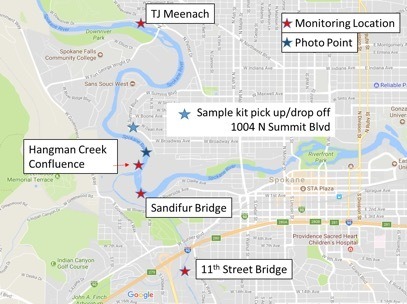
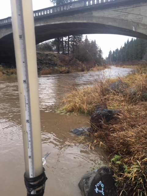
Turbidity readings will be taken several times per week from Hangman Creek and the Spokane River above and below the mouth of Hangman Creek between December 1, 2021 and July 1, 2022. Samples will be taken in Hangman at Peoples Park or the 11th Street Bridge, in the Spokane River at Sandifur Bridge, below the TJ Meenach Bridge and below the Hangman Creek confluence with the Spokane River. Turbidity will be determined using a transparency tube and recorded in centimeters. Readings from Sandifur Bridge samples will be compared to readings from the TJ Meenach samples to determine the effect of Hangman Creek on the Spokane River.
In locations where the river/creek is not accessible from land, a jar/bucket will be lowered into the water with a rope off of a bridge. Water will be hauled up in the container and analyzed for turbidity.
 Volunteer information and Registration for the Dec 2025 – June 2026 Sediment Study Season
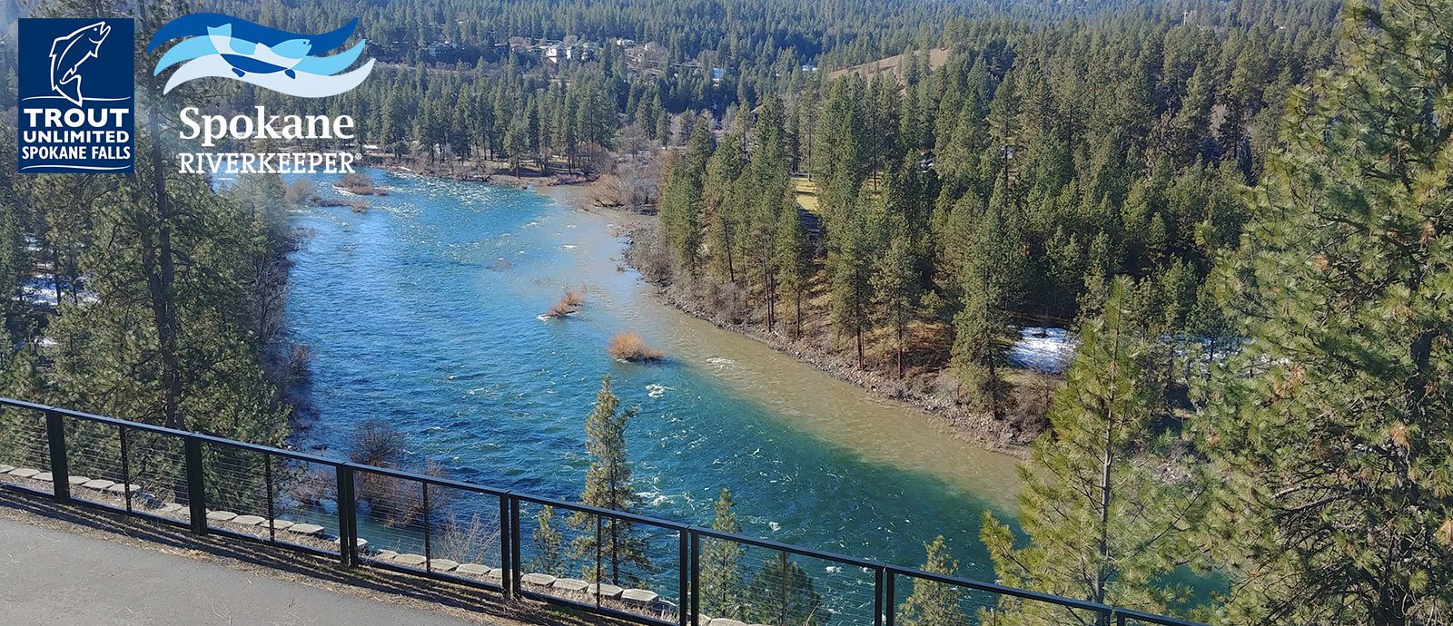


