
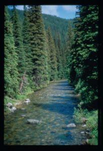
Project could affect the Cayuse Creek drainage, Chuck Pezeshki Photo Credit
The Forest Service is accepting public comments on their proposal to cut and/or burn approximately 8,600-acres in three different roadless areas in the N. Fork Clearwater drainage: Moose Mountain, Weitas Creek and Kelly Creek. The project also calls for commercial logging of over 400-acres just outside the areas.
Skip to the public comment form.
FOC has a number of concerns with the proposal. Below are talking points to consider.
- The project aims to improve “forest health,” despite the fact that the project largely occurs in roadless areas shaped by natural conditions. How can temporary road building, thinning, commercial logging and prescribed fire improve a mostly roadless landscape?
- Forest Service has already completed past prescribed burns in the area, and has a fire management plan to allow natural fires to burn in the same area. This project seems redundant and unnecessary.
- Project aims to meet “desired conditions” under the Forest Plan, yet, the desired conditions do not match those in the Forest Plan.
- Project could affect roadless character. It is unclear whether or not “mechanical treatment” (logging?) would occur inside the three roadless areas.
- Project could affect Cayuse Creek, which delivers some of the coldest and cleanest water to the N. Fork. Cayuse Creek also provides crucial habitat for Westslope-cutthroat and bull trout.
- Proposal claims to offer potential positive economic impacts to the region, despite this being a remote backcountry setting. If the logs were sold they would most likely go to mills in MT not ID. Project could affect prized Cayuse Creek fishery.
- Toboggan Ridge Rd #581 has frequent washouts, and should be de-commissioned.
Public comment deadline is Friday July 28. Comments can be mailed to: Stephanie Israel, NEPA Planner, 12730 HWY 12, Orofino, Idaho 83544 or you can use the comment form here.
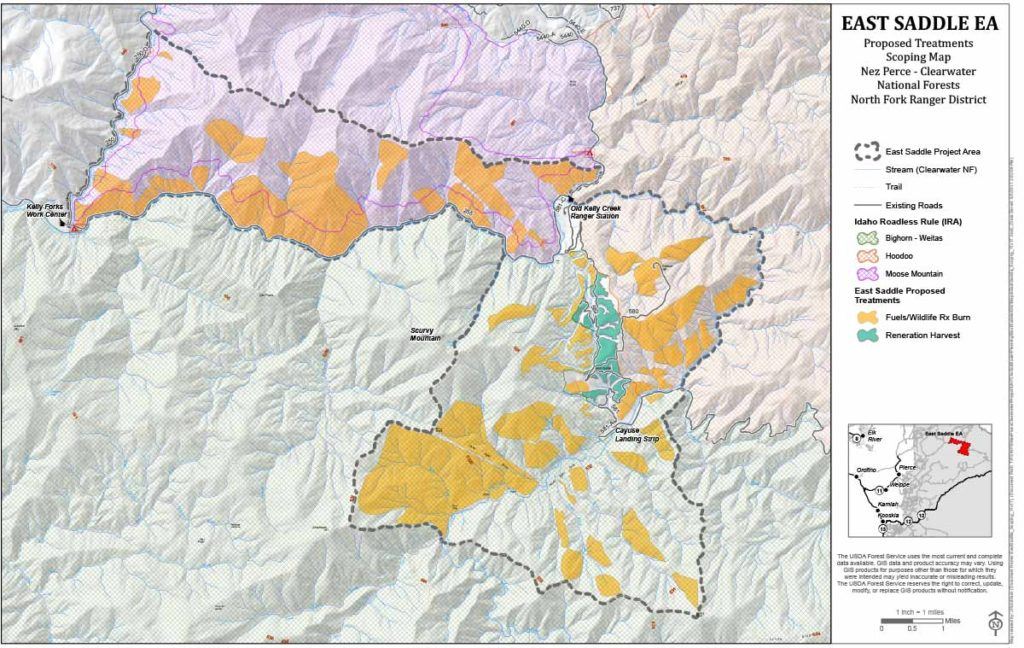 Download the Project Area Map.pdf